
Mikhail Zhizhin
Payne Institute for Public Policy, CSM
Shifting Landscapes: Nighttime Lights and Fires in Conflict Zones.

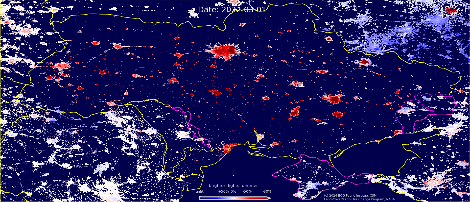
We investigate the impact of war on nighttime light intensity and fire activity using multispectral imagery from the Suomi NPP, NOAA-20, and NOAA-21 satellites. The analysis incorporates the visible Day-Night Band (DNB) and nine short-, mid-, and long-infrared bands for the period 2012-2024. Focus regions include Ukraine, Sudan and neighboring countries, and the Middle East.
Building on nighttime light time series analysis, a Dimming Lights Ratio (DLR) index was developed to compare relative radiance changes before and after war events while accounting for seasonal surface reflectance variations. Assuming consistent cloud, snow and vegetation patterns across years, iterated calculations within specific date ranges produced time series of light variation maps. This resulted in thousands of raster images illustrating dimming patterns across Ukraine, Sudan, and the Middle East. A custom color palette enhanced visualization of these daily raster images, creating dimming index animation movies to effectively represent and quantify daily socioeconomic changes during wartime.
Nightly fire and industrial infrared (IR) emitter maps, generated from the VIIRS Nightfire detections database, enabled the differentiation of city lights from those associated with frontline and war-damaged infrastructure.
Collectively, these observations enable independent verification of limited ground-based reports concerning the progression of the war, as well as regional fluctuations in population density and economic output.