Implementation period: June – December 2022
Customer: ESA, WorldCereal project
Executant: Anhalt University of Applied Science, NTUU KPI
The main objective of WorldCereal is to develop – building on existing community initiatives, open and free EO sources, new algorithms, ICT infrastructure and reference datasets – an open-source, efficient, agile and robust EO based system to timely monitor the global cropland extent at field scale.
Our participation in the ESA WorldCereal flagship project was made possible thanks to the created Ukrainian-German center of key competences – Center for Artificial Intelligence for Big Data and Telecommunications (AIDA-TI), which was formed jointly by two universities – Anhalt University of Applied Science and National Technical University of Ukraine. Igor Sikorsky Kyiv Polytechnic Institute” (NTUU KPI). This project took place due to the opportunity to participate in European projects of Anhalt University (Ukraine does not have such prerequisites), and 6 years of experience in machine learning and satellite data field of NTUU KPI specialists.
We were connected at the final stage of the project, when all the products (maps of the grain crops and agricultural land classification) were already received and the question of their quality assessment and validation arose.
The main goal of our participation in the project is the historical and modern grain classification maps validation, which were created in the WorldCereal project for the territory of Ukraine. The in-situ data from ground surveys collected by experts along the roads, own classification maps based on neural network algorithms and time series of satellite data for the territory of Ukraine, information from the State Statistics Service of Ukraine, as well as data from farmers are used for validation. Classification maps, on the basis of which WorldCereal products are validated, are already actively used at the state level and are publicly available, in particular on the public Cadastral map of Ukraine and in the system of the State Agrarian Register of Ukraine.
The routes planning for in-situ data collection was based on analysis of time series satellite data and official statistical data. The route for in-situ data collection is focused on the accumulation of the maximum number of crops, as well as their maximum diversity. In-situ data collection performed according to JECAM guidelines for in-situ data collection provided in “JECAM Guidelines for cropland and crop type definition and field data collection” & FrançoisWaldner et. all. “Roadside collection of training data for cropland mapping is viable when environmental and management gradients are surveyed”. In particular, provided in section III, “Field data collection for cropland and crop type” recommendations were used for in-situ data collection campaign design.
According to these recommendations 2 routes were built for field data collection in 2019. One of them for winter crops data collection (Fig. 1-a), and another for summer crops (Fig. 1-b). They uniformly cover the territory of Ukraine taking into account stratification (agricultural areas) and the availability of roads. The route for winter crops in 2019 was about 1700 km, for the summer crops in 2019 – 4 400 km. Similar routes for 2020 are shown in fig. 2.
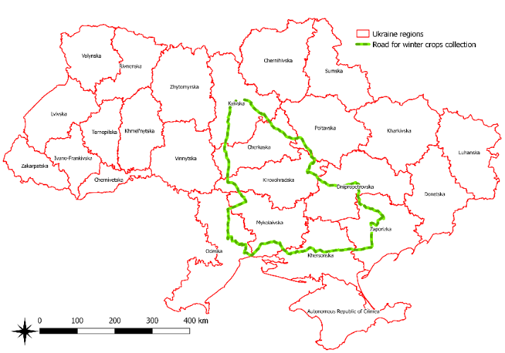
Fig. 1-a The route for winter crops data collection along the roads in 2019 |
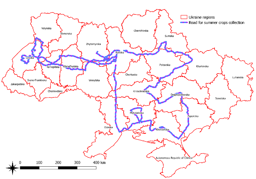
Fig. 1-b The route for summer crops data collection along the roads in 2019 |
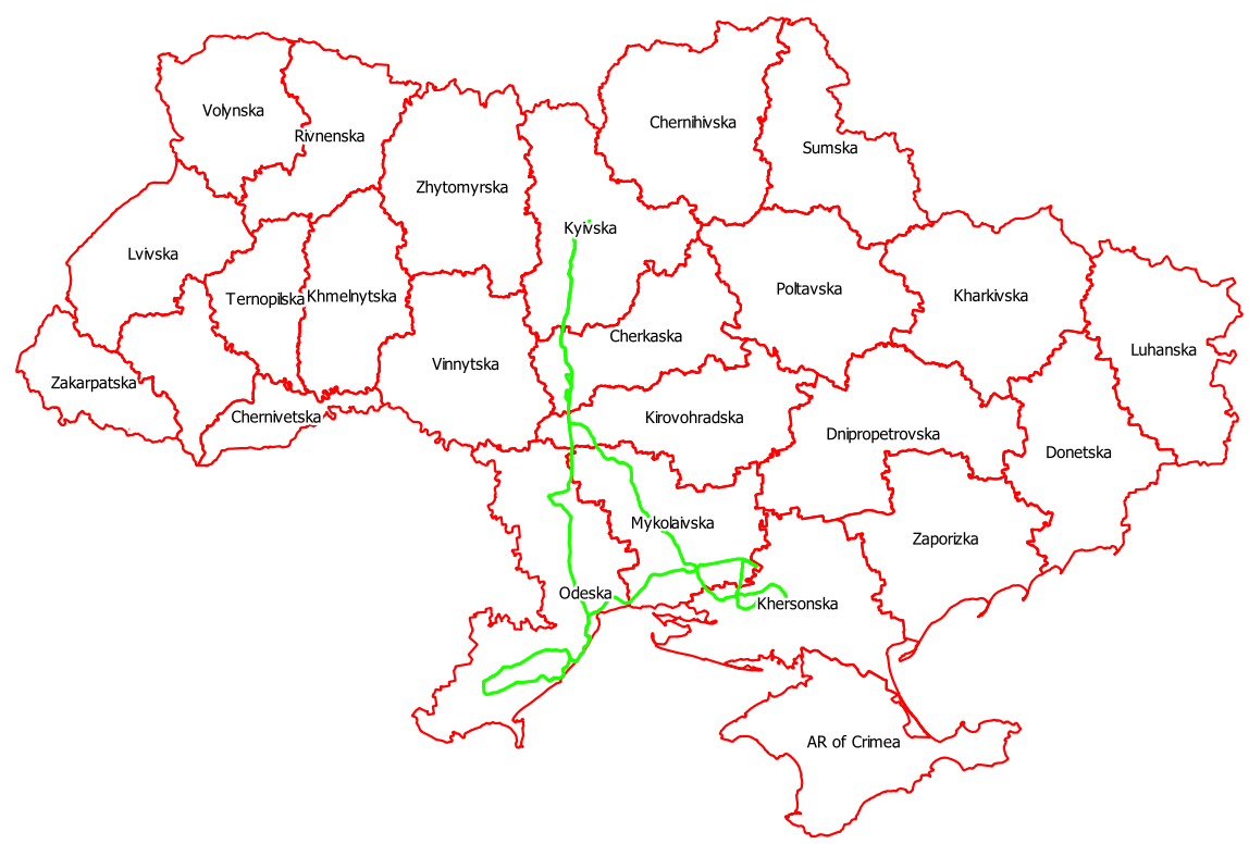
Fig. 2-a The route for winter crops data collection along the roads in 2020 |
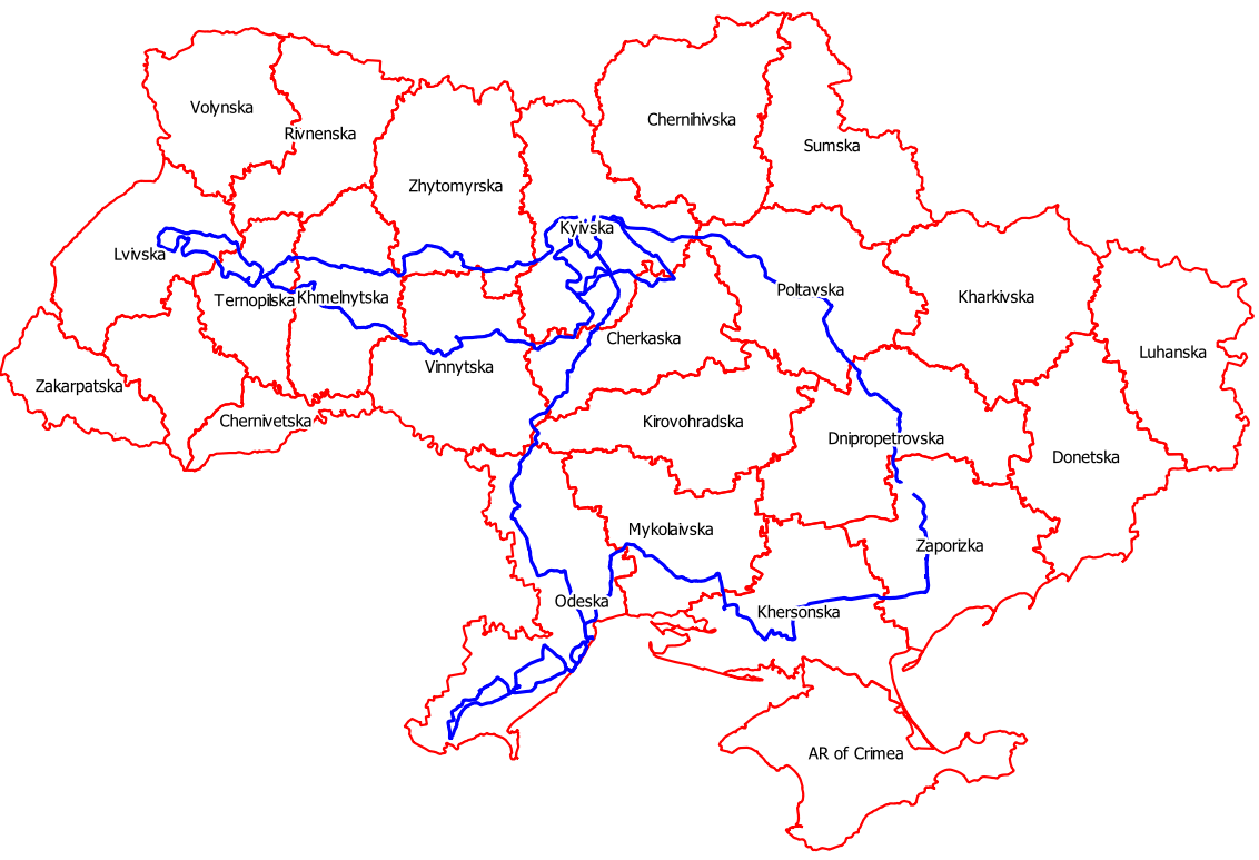
Fig. 2-b The route for summer crops data collection along the roads in 2020 |
An additional way of the classification maps’ validation is to compare the areas of cereal and maize obtained from WorldCereal maps with maps obtained by NTUU KPI (A. Shelestov et al., N. Kussul et al., K. Deininger et al.). For this task the classification maps for 2019 and 2020 were used. On Fig. 3 classification maps for 2019 (Fig. 3-a) and 2020 (Fig. 3-b) are presented. WorldCereal maps for 2019 (Fig. 4-a) and 2020 (Fig. 4-b) are also presented below.
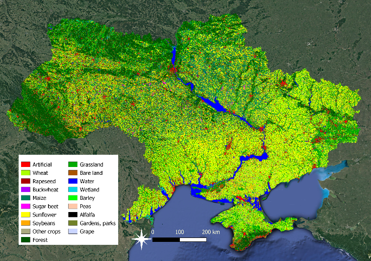
Fig. 3-a NTUU KPI Classification map 2019 |
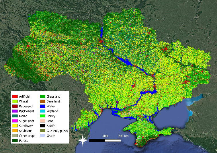
Fig. 3-b NTUU KPI Classification map 2020 |
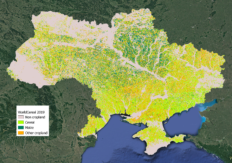
Fig. 4-a WorldCereal Classification map 2019 |
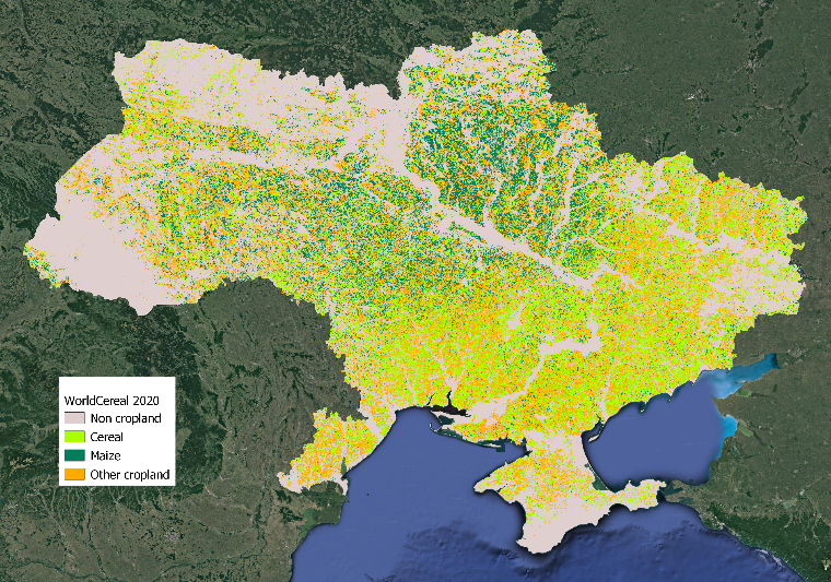
Fig. 4-b WorldCereal Classification map 2020 |
Activities within the project:
Зустріч за проєктом WorldCereal в Міжнародній метеорологічній організації