On June 23, 2021, a closed IRLOGI e-shape WORKSHOP took place, which is part of an e-shape project funded by Europe.
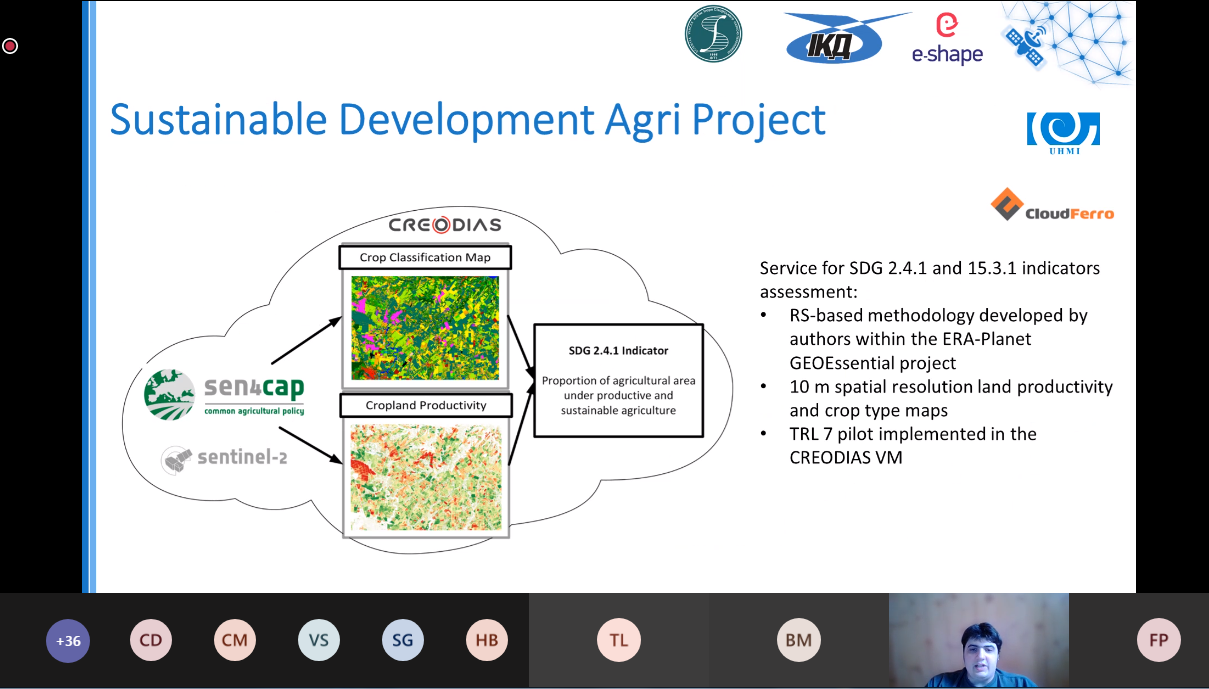
During the workshop for Irish Organization for Geographic Information and Irish stakeholders in the field of agribusiness, three projects were presented, one of which is implemented by the Space Research Institute of NAS of Ukraine and SSA of Ukraine (Department of Space Information Technologies and Systems), in collaboration with Institute of Physics and Technology NTUU “Igor Sikorsky Kyiv Polytechnic Institute” (Department of Mathematical Modeling and Data Analysis), including the project “Service for SDG 2.4.1 and 15.3.1 Indicators” was presented by our young colleague and project participant Leo Shumilo.
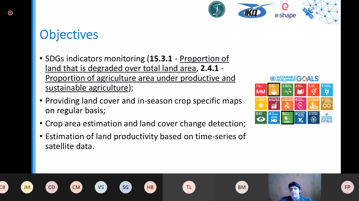
Within the framework of this project it is planned to develop technology for assessment of sustainable development goal indicators 2.4.1 “Proportion of agricultural area under productive and sustainable agriculture” and 15.3.1 “Proportion of land that is degraded over total land area” for the territory of Ukraine with the possibility of scaling the obtained technology to other countries using modern Sen4Cap technologies in the CREODIAS cloud platform. The methodology was developed within the European project H2020 ERA-PLANET GEOEssential.
After the presentation of the projects there was a detailed discussion on the topic of each of the projects.