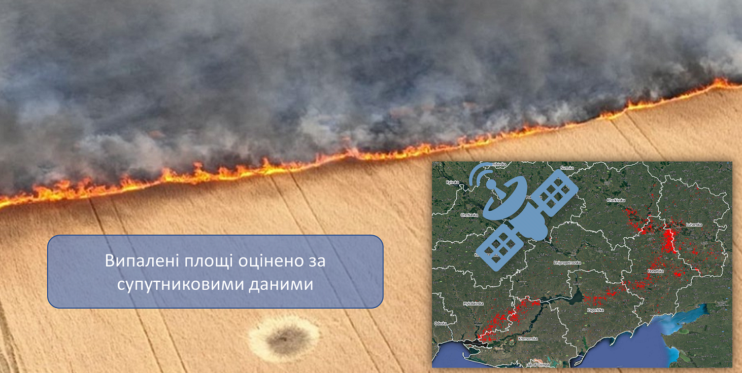
Employees of the Educational and Research Institute of Physics and Technology NTUU “Igor Sikorsky Kyiv Polytechnic Institute” together with specialists of the Space Research Institute of the National Academy of Sciences of Ukraine and the SSA of Ukraine determined the burned areas of Ukraine using satellite data. Only in July 2022, about 70 thousand hectares of grain crops were damaged along the front line. Taking into account that the average wheat harvest in 2021 was 45.3 t/ha (according to the State Statistics Service of Ukraine), and the fires occurred precisely during the harvest of grain crops, the possible losses from fires along the front line amount to 3.17 million quintal or 317,000 tons of grain.
According to Oleksandr Stavrukh, the head of Zaporizhzhya OVA:
“9,693 hectares of fields were damaged by Russian shelling in the Zaporizhzhia region. Approximately 30-40 thousand tons of grain were destroyed by the Russians”
Stavrukh’s words are confirmed by information from satellite observations, in particular, in the Zaporizhzhia region, fire-damaged territories on an area of 9,173 hectares were identified only in July.
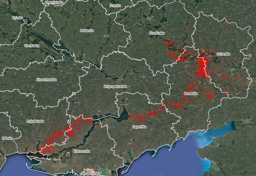
The territories of the natural ecosystem were also significantly affected, in particular grassland (16,700 hectares burned) and forest (1,100 hectares).
More detailed information on the distribution of damaged areas in agricultural areas and natural ecosystems is given in the table (in hectares). The damage estimates from the Sentinel-2 satellite data are only a lower estimate, as this satellite only allows monitoring of the burned area if there were no clouds at the time of the satellite image.
| Cereal crops | Rapeseed | Summer crops | Non cultivated in 2022 | Grassland | Forest | Total | |
| Donetska | 25823,7 | 4,3 | 144,8 | 864,07 | 9258,51 | 266,3 | 36361,6 |
| Khersonska | 10843,2 | 87,3 | 4129,4 | 3831,48 | 853,43 | 150,6 | 19895,3 |
| Mykolaivska | 14556,3 | 41,0 | 1398,2 | 2382,65 | 582,25 | 286,8 | 19247,1 |
| Zaporizska | 9173,0 | 81,2 | 1774,7 | 810,91 | 637,55 | 61,4 | 12538,8 |
| Luhanska | 3396,0 | 30,1 | 175,3 | 308,37 | 4550,68 | 287,7 | 8748,2 |
| Kharkivska | 5395,0 | 0,1 | 43,2 | 39,58 | 729,44 | 87,1 | 6294,4 |
| Dnipropetrovska | 745,6 | 7,7 | 152,4 | 53,32 | 109,64 | 2,5 | 1071,2 |
| Poltavska | 45,1 | 13,1 | 1,0 | 0,7 | 0,18 | 0,0 | 60,1 |
| Odeska | 3,0 | 0,0 | 7,7 | 0,12 | 1,67 | 0,0 | 12,6 |
| Total | 69980,9 | 264,8 | 7826,6 | 8291,2 | 16723,4 | 1142,4 | 104229,2 |
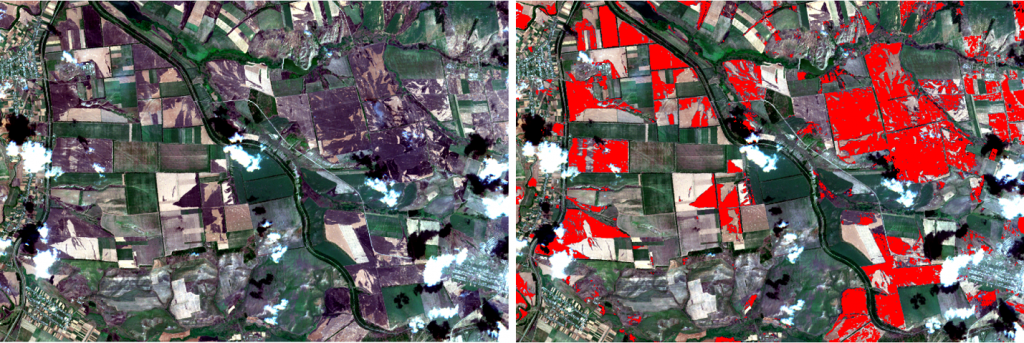
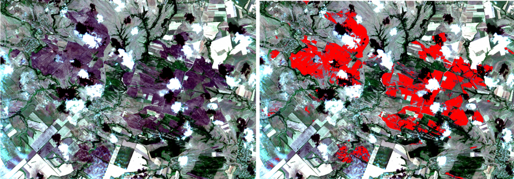
Below are examples of burned agricultural fields and grassland.
The evaluation technology for monitoring burned areas was developed and tested within the framework of the project of the National Research Fund of Ukraine “Information technology for assessing fire danger and monitoring fires in natural ecosystems based on satellite data.” To obtain information about the type of land cover and the corresponding culture, land cover classification maps, which are annually received by department specialists within the framework of the World Bank project, were used. This year, thanks to the European initiative EO4UA, we also have the opportunity to continue our research on CREODIAS cloud resources and obtain products that are the basis of analysis for the economy and food security not only of Ukraine, but also of many countries that are importers of Ukrainian grain. Read about the quantitative assessment of crop losses caused by the war in Ukraine in our joint article with representatives of the World Bank and the Joint Research Center.
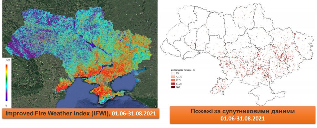
Also within the framework of the project of the National Research Fund of Ukraine, we developed and improved the fire hazard monitoring technology using the Improved Fire Weather Index. As we can see from the image, in the summer of 2021, fires were evenly distributed across the southern and eastern parts of Ukraine in most of the territory of Ukraine, which corresponded to the Improved Fire Weather Index. Some of the fires were indeed caused by weather conditions, as predicted by the Improved Fire Weather Index, and some by human factors during the burning of stubble in agricultural fields after harvest.
This year, the situation has changed significantly, because according to the fire danger index, with the help of weather conditions, fires can occur only in the southern part of the country (Mykolaiv, Kherson and Odesa regions). While real fires reproduce the front line, that is, they are caused only by human intervention – from missiles and bombs.
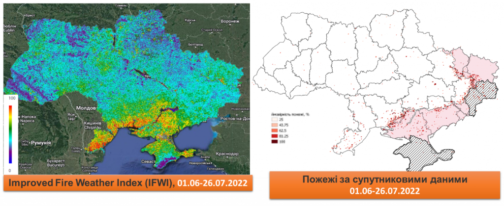
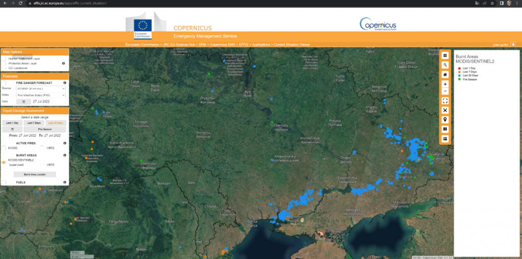
Similar information for the period from June 27 to July 27, 2022 was also received from the European Commission (Joint Research Centre, European Commission), where almost all burns on the territory of Ukraine are concentrated along the front line. This information is derived from a combination of MODIS and optical Sentinel-2 fire data.