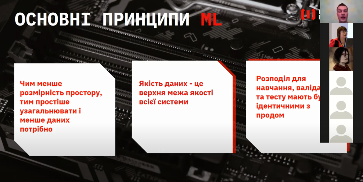
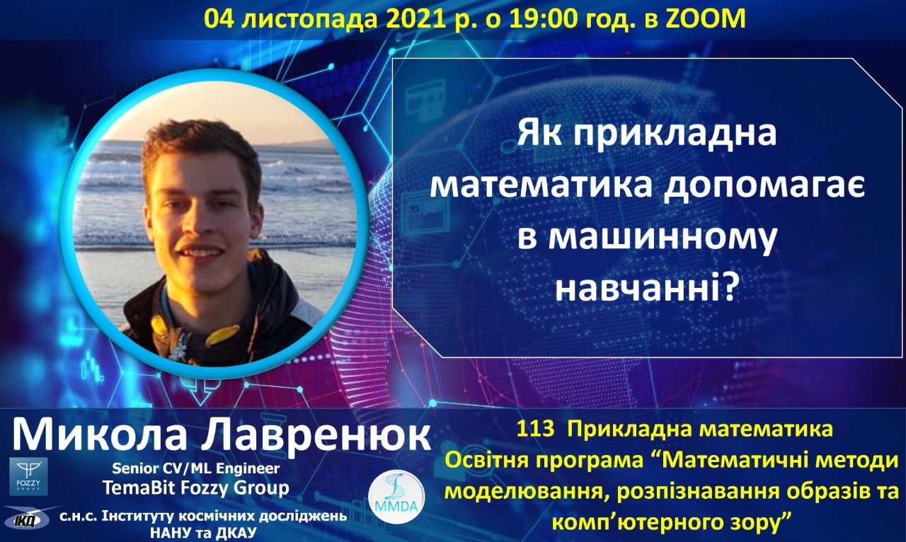
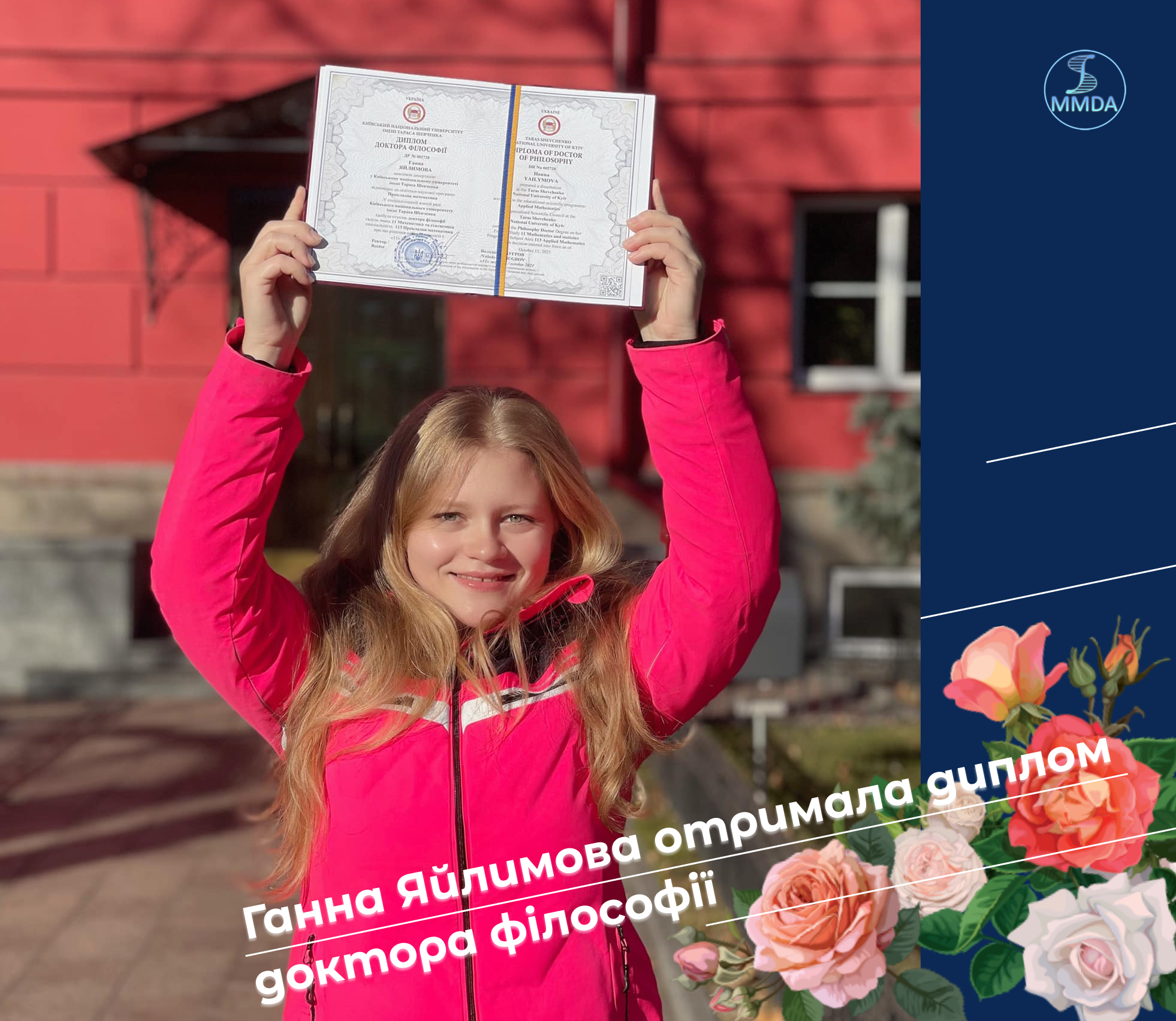
Master-2022

The Mathematical Modeling and Data Analysis Department of “Igor Sikorsky Kyiv Polytechnic Institute” offers the master level “Mathematical methods of modeling, pattern recognition and computer vision” educational program on the specialty 113 “Applied Mathematics”.

Term of study for the master program is 1 years and 9 months.… Continue reading

IAMO-Forum

On June 24-26, 2020, the IAMO2020 forum was held – an online conference on “Digital transformation – towards sustainable food value chains in Eurasia”. Teachers of the department took part in the forum: Nataliia Kussul with a report on the topic “World band project “Supporting Transparent Land Government in Ukraine” as a step towards the digitalization of Ukraine economy and ecology” and Andrii Shelestov with a presentationMonitoring of SDG’s indicators and agricultural lands productivity using Amazon Cloud Platform”

The main goal of the IAMO2020 forum is to combine the scientific component, business, civil society and policy to facilitate discussions on the economic, social, environmental and institutional aspects of the digital transformation of the food value chains.… Continue reading

Geospatial models and information technologies of satellite monitoring of smart city problems

Project within NRFU Competition “Leading and Young Scientists Research Support”

The project duration: 2020 – 2022

Supervisor: prof. Andrii Shelestov

Project abstract

Digital technologies for the ecological state monitoring and city development have become important for society and various stakeholders. Thanks to the emergence of new sources of open data, there are opportunities to develop and implement services that are already used in the European Union (EU) and European cities.… Continue reading

Intelligent models and methods for determining land degradation indicators based on satellite data

Project within the NRFU competition “Science for the safety of human and society”

Project duration: 2020-2021

Supervisor: prof. Andrii Shelestov

Project abstract

The problem of land degradation is relevant today. Many signs of land degradation, such as declining crop yields, deforestation identification or uncultivated land cultivation, can be tracked using satellite data, in particular vegetation indices.… Continue reading

Amazon-GEO

Project name: Methodology for SDGs indicators assessment

Acquirer: Group on Earth Observation

Project leader from Ukraine: PhD, prof. Nataliia Kussul

Period of execution: 2019 – 2022

Link to the program description: https://www.earthobservations.org/aws.php

About project

As part of the Amazon Sustainability Data Initiative (ASDI), the program allows remote sensing of the Earth and the creation of applications to support sustainable development, including the UN Sustainable Development Goals, the Sendai Framework for Disaster Risk Reduction, and the Paris Agreement on Climate Change.… Continue reading

H2020 ERA-PLANET GEOEssential

Acquirer: European Commission

Project leader from Ukraine: Prof. Nataliia Kussul

Project Coordinator: Anthony Lehmann, Université de Genève, Switzerland

Duration: 01.09.2017 – 31.08.2020

Project Overview

GEOEssential (Essential Variables workflows for resource efficiency and environmental management)  is addressing the need for trusted sources of data and information to monitor the progresses made on environmental conditions towards policy targets.… Continue reading

H2020 ERA-PLANET SMURBS

Acquirer: European Commission

Project leader from Ukraine: Prof. Nataliia Kussul, Prof. Andrii Shelestov

Project Coordinator: Evangelos Gerasopoulos, IERSD/National Observatory of Athens, Greece

Project Overview

SMart URBan Solutions for air quality, disasters and city growth (SMURBS) ultimate goal is to promote the “smart-city” approach, serving the need for a common approach to enhance environmental and societal resilience to specific urban pressures, through the integration of EO.… Continue reading