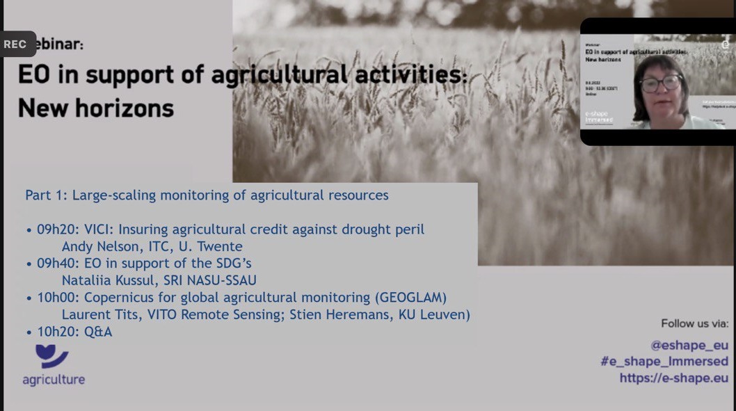
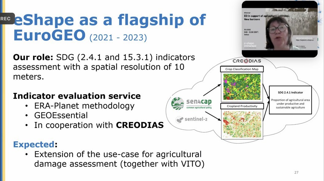
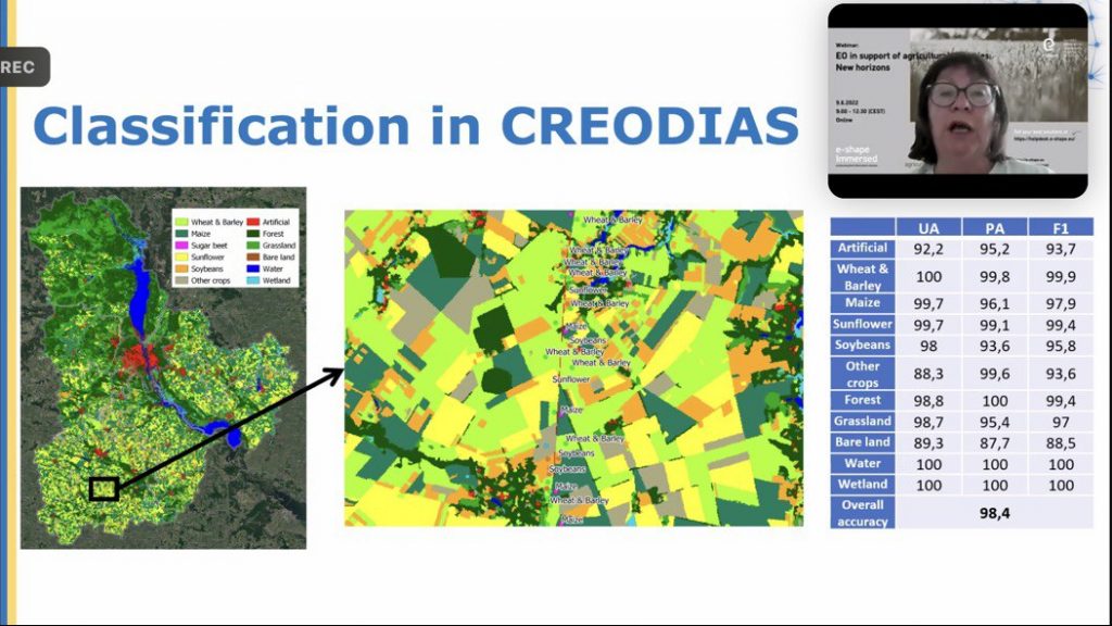
On June 9, 2022, a webinar on the international project e-shape “EO in support of agricultural activities: new horizons” was held, where participants presented their work within the respective pilots. In particular, prof. Nataliia Kussul presented the preliminary results of the Ukrainian team’s work on pilot 1.6, in which participants assess the indicator of sustainable development goals 2.4.1 “Proportion of agricultural area under productive and sustainable agriculture” and 15.3.1 “Proportion of land that is degraded over total land area” on the cloud CREODIAS platform and based on the analysis of satellite time series and land cover classification maps.
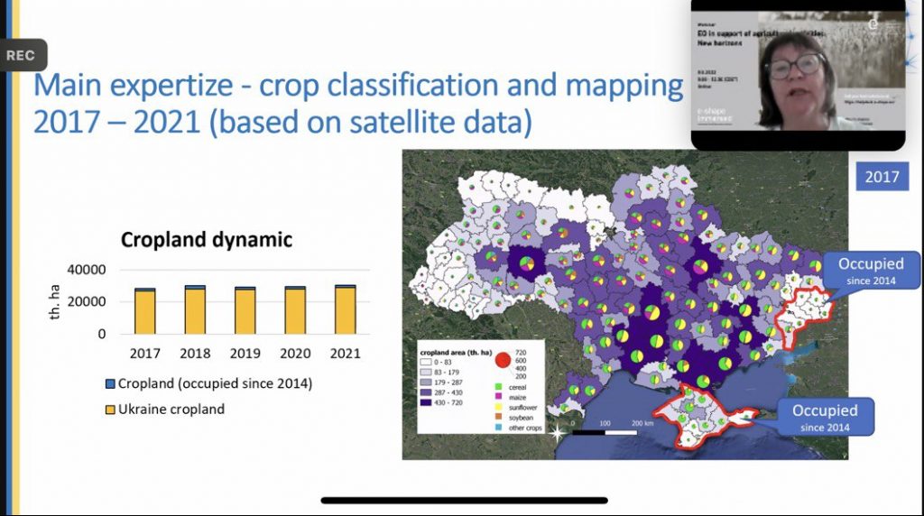
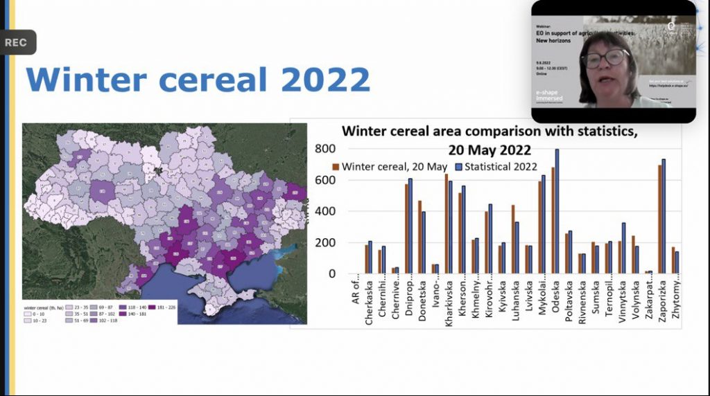
With the beginning of the war, the international initiative Earth Observation for Ukraine (EO4UA) was created, the initial results of which were also presented at the webinar. In particular, it is an estimate of crop areas throughout Ukraine for 2017 – 2021 years with an estimate of occupied agricultural land and an estimate of sown areas of winter crops in 2022. Within the framework of this initiative, a geoportal has been created, on which the results of the initiative’s work will be covered in the public domain.
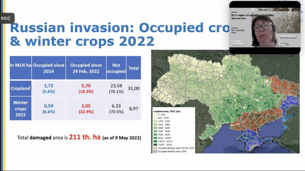
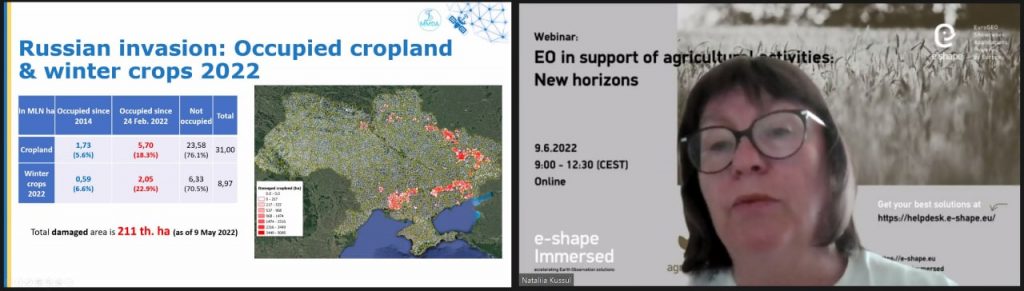
In addition to the areas for monitoring the sustainable development goals, which are the main ones within the pilot, the analysis of losses of agricultural areas based on satellite data for the period of hostilities in 2022 in Ukraine using the cloud platform and computing resources CREODIAS.
The full recording of the webinar can be found at the link, and the presentation of the Ukrainian pilot begins at 31 minutes of video.