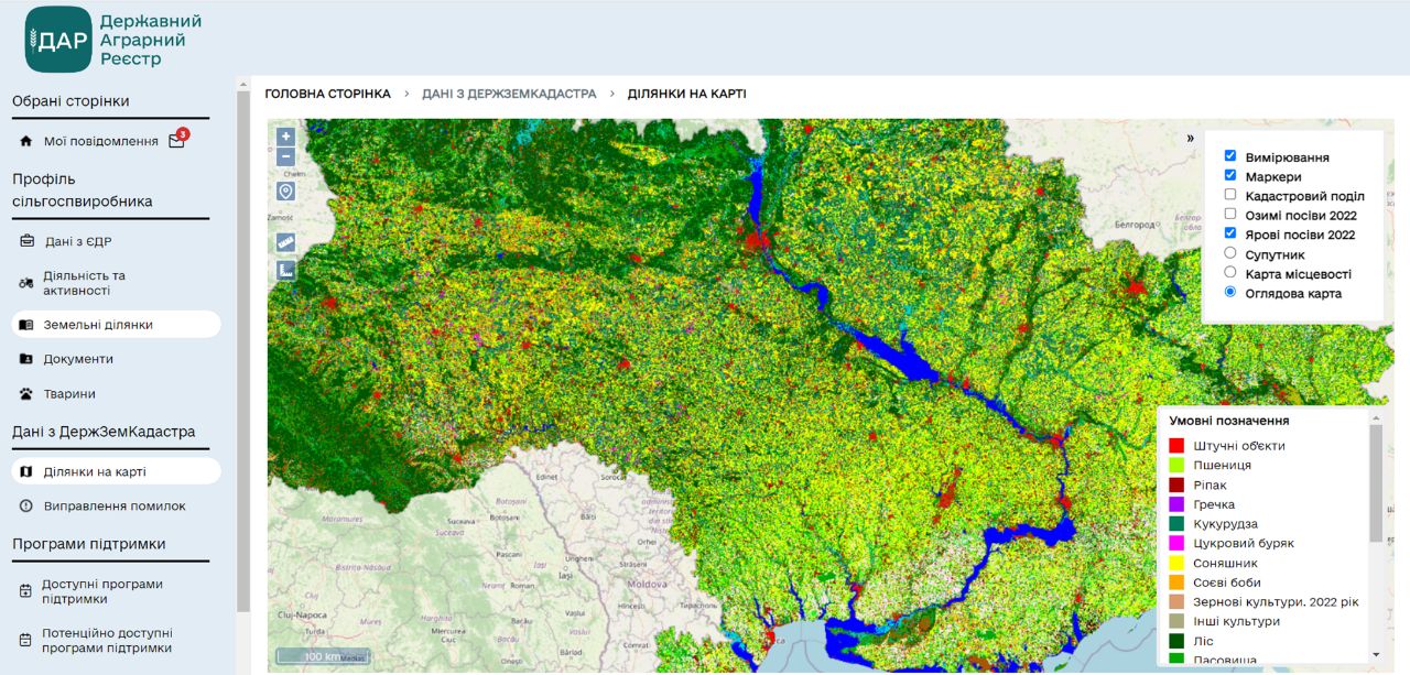
Thanks to the specialists of the MMDA department (names), the electronic system “State Agrarian Register” was able to update the information on satellite maps of crop recognition. The classification maps were created as part of the World Bank and EU programme “Supporting Transparent Land Use in Ukraine” and the National Research Foundation of Ukraine project “Intelligent Models and Methods to Identify Indicators of Land Degradation Based on Satellite Data”. The information provided has helped to improve the functionality in the relevant sections and allowed representatives of organisations to independently verify the condition of land to be involved in support programmes.
According to Denis Bashlyk, Deputy Minister of Agrarian Policy and Food of Ukraine for Digital Development, Digital Transformation and Digitalization, synchronization of satellite map data with real data from agricultural producers will be an invaluable source of statistical information for development and improvement of government policies in the agricultural sector, and will improve the quality of satellite monitoring of yield forecasts.