The EUSpace4Ukraine initiative published a White Paper and interactive maps of cropland based on data obtained by our staff using machine learning methods and Copernicus open satellite data.
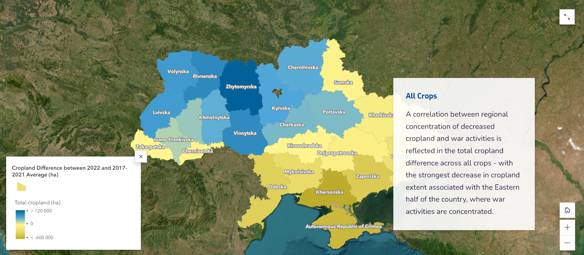
Total agricultural land area in 2022, compared to the 2017-2021 average for all crops, decreased by approximately 7% (almost 2 million hectares), while the most affected crops (wheat/barley, sunflower and corn) experienced a decrease in agricultural area land up to 13%.
The article also notes the scientific publication of the department’s scientists Nataliya Kussul, Sofia Drozd and Hanna Yalymova together with colleagues from the World Bank and JRC, which shows the dynamics of yield changes in Ukraine since the beginning of the war. Satellite data are now indispensable for assessing agricultural performance from space or where ground-based surveys are impossible or unsafe.
The European Union (EU) Space Program Agency (EUSPA) launched the EUSpace4Ukraine initiative in April 2022 with the start of the war in Ukraine. The purpose of this publication, which demonstrates the assessment of the impact of war on the agricultural sector using the Copernicus program, is to support and implement the innovations of the EU Space Program for the humanitarian sector operating in Ukraine.
You can read more about it at the following links:
▪️ https://www.euspa.europa.eu/newsroom/news/euspace4ukraine-white-paper-storymap-copernicus
▪️ https://storymaps.arcgis.com/stories/574740c9e7734bffb86d407e383a1255